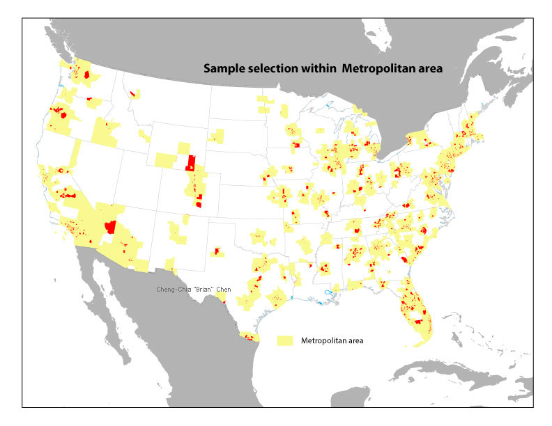
The purpose of this project is to use nationally representative data and metropolitan statistical area (MSA) as the analytic unit to investigate the relationship among walkability, physical activity, food outlet density, expenditure of fast food, and trajectories of BMIs.
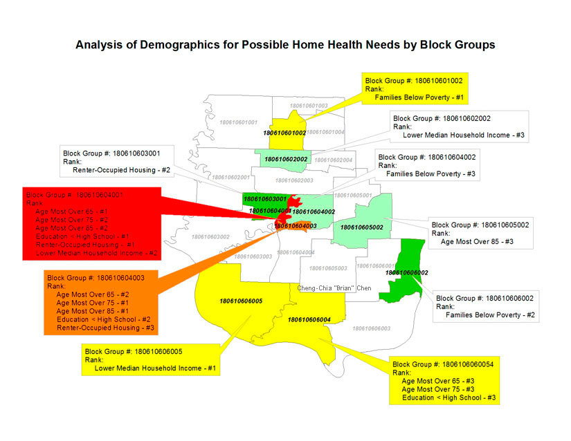
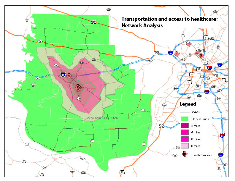
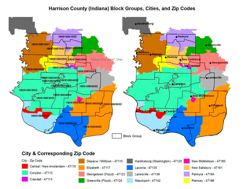
This study was conducted to provide information for nonprofit organization in Harrison County in regards to home health care availability, gaps in service, and related needs for services. This is a project subject to the lifespan of all Harrison County residents that are homebound, have limited mobility, limited available transportation, and those living with high levels of medical care.
Selected figures showing results of geostatistics, network analysis on rural transportation services, and side-by-side simultaneous illustration of block groups and zip codes for project clients
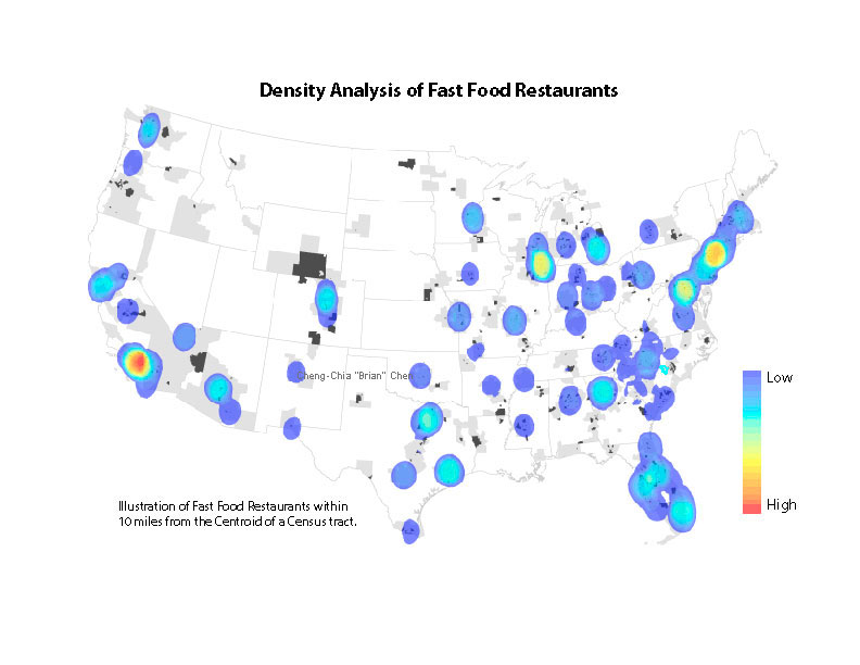
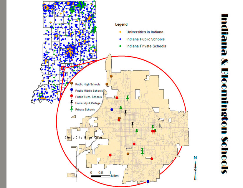
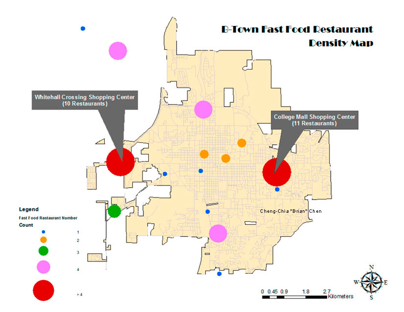
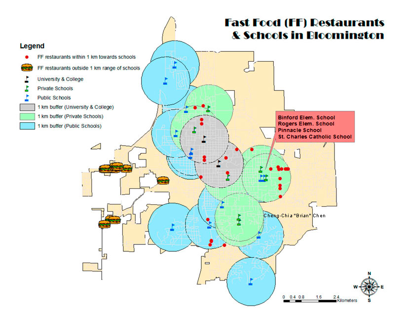
This project was S603 course final assignment. The main purpose was to investigate the distribution of the Fast Food restaurants and schools from a local entity (e.g., Bloomington/Monroe County) in Indiana to provide preliminary information for further research opportunities.
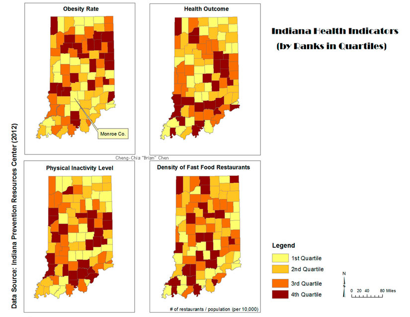
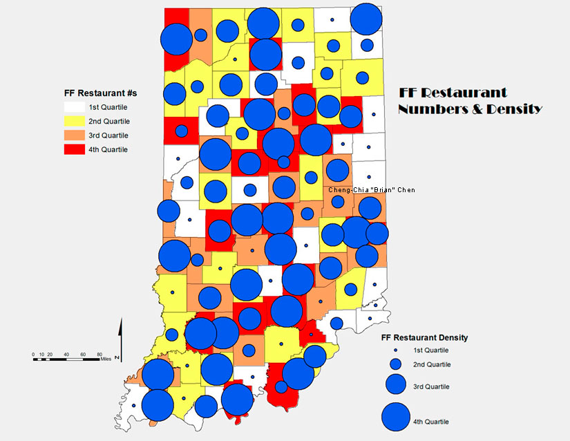
Application of geocoding and various spatial analyses on Indiana health indicators, obesity determinants at local level in Bloomington, Indiana
8-Week Instructor-Led Training Course (1.5 Credits), Indiana University, Bloomington, IN
Certificate of Completion, ArcGIS Desktop Workshop: Getting Started with GIS (3 contact hours), Indiana University-Purdue University, Indianapolis, IN
Certificate of Completion, ArcGIS Desktop Workshop: Geocoding & Spatial Analyses (3 contact hours), Indiana University, Bloomington, IN
Learning ArcGIS Desktop
Getting Started with GIS
Learning ArcGIS Spatial Analyst
Turning Data into Information Using ArcGIS 9
Geoprocessing with ArcGIS Desktop
Understanding Geographic Data
Creating, Editing, and Managing Geodatabases for ArcGIS Desktop
Python Scripting for Map Automation in ArcGIS 10
Certificate of Completion, Up and Running with ArcGIS with Adam Wilbert (3 hours)
Certificate of Completion, Real-World GIS with Jason VanHorn(3 hours)
Certificate of Completion, GIS on the Web with Jason VanHorn(2 hours)
This presentation was given to GIS beginners to learn more knowledge on the background and versatile applications to different public health research topics. Critical and basic concepts such as georeference, georelational data models were discussed in details.